Bartram Trail
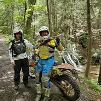
Bartram Trail Lenght: 37.7 miles Estimated Time: 3-5 Days (287 reviews) Type: Point-to-point trail Difficulty: Hard Elevation: 7,903 ft total elevation gain GPS Coordinates: 34.8765° N, 83.7234° W (Russell Bridge) Emergency Contact: (706) 754-6221 Address: None Given Hours: None Given Allowed Activates Hiking Backpacking Trail Running Photography Birdwatching Dog Walking (on leash) Camping (designated areas) Waterfall Trail Sections Russell Bridge to Warwoman Dell Distance: 18.8 milesDifficulty: Moderate to HardHighlights: Chattooga River, Dicks Creek Falls, Rainy Mountain Trail Section Page Russell Bridge to Warwoman Dell Distance: 18.8 milesDifficulty: Moderate to HardHighlights: Chattooga River, Dicks Creek Falls, Rainy Mountain Trail Section Page Russell Bridge to Warwoman Dell Distance: 18.8 milesDifficulty: Moderate to HardHighlights: Chattooga River, Dicks Creek Falls, Rainy Mountain Trail Section Page Amenities & Logistics PARKING Russell Bridge (Southern Terminus): Free parking on north side of Highway 28 Warwoman Dell: Free parking at recreation area (two lots available) Rabun Bald Access: Limited parking at Hale Ridge Road trailhead Northern Terminus: Roadside parking at Georgia-NC border RESTROOMS & FACILITIES Russell Bridge: No facilities Warwoman Dell: Restrooms temporarily unavailable (check current status) Along Trail: No facilities – wilderness setting Nearest Towns: Clayton (18 miles from Russell Bridge), Highlands, NC KID FRIENDLY Full Trail: Not suitable for young children due to length and remoteness Warwoman Dell Area: Excellent for families with short waterfall trails Rabun Bald Day Hike: Suitable for teenagers and fit older children Educational Value: William Bartram history, botanical diversity, CCC heritage PICNIC AREAS Warwoman Dell: Two CCC-built picnic shelters, multiple tables Russell Bridge: Primitive area only Along Trail: No designated picnic facilities FEES No entrance fees anywhere along trail Free parking at all access points Forest Service land – no permits required for day hiking Backcountry camping allowed with Leave No Trace practices SHUTTLE SERVICES Multiple local outfitters provide shuttle services for point-to-point hiking. Recommended to arrange in advance, especially during peak seasons. RESUPPLY OPTIONS Warwoman Dell: Only on-trail resupply point Clayton, GA: Full services 18 miles east of Russell Bridge Highlands, NC: Services near northern terminus Pre-arranged caches: Possible at Warwoman Dell with coordination Trail Overview Following the footsteps of 18th-century naturalist William Bartram, this National Recreation Trail explores some of Georgia’s most pristine wilderness. Stretching 37.7 miles from Russell Bridge on the Chattooga River to the North Carolina border, the trail offers both outstanding day hikes and a fantastic multi-day backpacking adventure through the Chattahoochee National Forest. William Bartram traveled this area in 1775, gathering and documenting botanical specimens from these extremely biodiverse forests. According to historical records, he documented well over a hundred new species of flora and fauna, making this trail both a wilderness adventure and a journey through natural history. The trail begins at the Wild and Scenic Chattooga River, following its banks through pristine forest before ascending into the Blue Ridge Mountains. The route passes through diverse ecosystems, from riverside hardwood forests to high-elevation heath zones, offering hikers a comprehensive sample of Southern Appalachian biodiversity. Major highlights include the spectacular 360-degree views from Rabun Bald’s observation tower, the cascading beauty of multiple waterfalls, and the historic significance of Warwoman Dell. The trail offers numerous excellent campsites with seasonal water sources, making it ideal for both section hiking and full trail backpacking adventures. Key Highlights: Rabun Bald (Georgia’s 2nd highest peak) Martin Creek Falls and Becky Branch Falls Wild and Scenic Chattooga River Pinnacle Knob side trail Historic Warwoman Dell Diverse botanical specimens Gear Up for Your Next Adventure Every trail has its challenges. Make sure you’re prepared with gear that goes the distance. Shop Now Activity-Specific Information For Hikers: Well-marked with yellow rectangular blazes throughout. Allow 3-5 days for full trail or choose individual sections for day hikes. Most popular day hikes include Warwoman Dell waterfalls and Rabun Bald summit. For Backpackers: Excellent multi-day adventure with numerous primitive campsites. Water sources generally reliable but carry purification. Bear precautions recommended. Leave No Trace principles essential. For Trail Runners: Challenging terrain suitable for experienced runners. Rabun Bald section particularly strenuous. Carry adequate hydration as water sources may be seasonal. For Nature Enthusiasts: Exceptional botanical diversity following Bartram’s historic route. Spring wildflowers outstanding. Bird watching excellent throughout. Educational opportunities about 18th-century natural history. For Photographers: Martin Creek Falls and Becky Branch Falls offer spectacular waterfall photography. Rabun Bald observation tower provides panoramic mountain vistas. Chattooga River access for water photography. Water Access Information RIVER ACCESS Chattooga Wild and Scenic River (Russell Bridge to Earl’s Ford) Multiple tributary streams throughout Historic Sandy Ford crossing WATERFALL ACCESS Dicks Creek Falls (0.5-mile side trail) Becky Branch Falls (roadside access) Martin Creek Falls (on main trail) SAFETY NOTES River currents can be deceptively strong Water levels change rapidly with weather All stream water requires purification Seasonal sources may be dry – plan accordingly Safety & Preparation Conditions: Trail generally in good condition with yellow blazing. River access requires careful navigation. Some overgrown sections in summer. Recommended Gear: Sturdy hiking boots, insect repellent, water purification, camera, rain gear, river shoes for crossings. What to Bring: 3+ liters of water plus purification Full day’s food supply First aid kit Navigation tools Insect protection River crossing footwear Hazards/Warnings: Multiple creek crossings Potential tick exposure River currents can be strong Remote wilderness sections Weather changes affect river levels Weather Considerations: Summer brings heavy vegetation and significant insect activity. Spring offers best water flow but challenging crossings. River levels rise quickly after rain.
Bartram Trail – Warwoman Dell to Rabun Bald
Bartram Trail – Warwoman Dell to Chattooga River Lenght: 18.8 miles Estimated Time: 8-10 Hours (287 reviews) Type: Point-to-point trail Difficulty: Hard Elevation: 640 ft elevation gain total Hours: None Given Emergency Contact: (706) 754-6221 Address: None Given GPS Coordinates: 34.8765° N, 83.7234° W Allowed Activates Hiking Trail Running Nature Photography Birdwatching Dog Walking (on leash) Backpacking Camping (dispersed) River Access Fishing Amenities & Logistics PARKING Free parking at Warwoman Dell Recreation Area Additional parking along Warwoman Road Russell Bridge parking area (southern terminus) Sandy Ford Road access (high-clearance vehicle recommended) RESTROOMS & FACILITIES Restrooms temporarily unavailable at Warwoman Dell (check status) No facilities along remote trail sections Water sources require purification Carry all needed supplies KID FRIENDLY Not suitable for young children due to length and remoteness Warwoman Dell area excellent for families with short trails River access may appeal to older children Educational opportunities about Native American history PICNIC AREAS Two picnic shelters at Warwoman Dell Scattered picnic tables along recreation area No facilities along wilderness trail sections Primitive camping opportunities FEES No entrance fees Free parking at all access points Trail Overview Following William Bartram’s historic 1775 route, this challenging section travels from the recreation area at Warwoman Dell to the pristine waters of the Wild and Scenic Chattooga River. The trail offers a true wilderness experience through some of Georgia’s most remote and biodiverse forest lands. Departing Warwoman Dell’s lush valley, the trail climbs over Rainy Mountain (2,560 feet) before following pleasant ridgeline walking on old forest roads. The terrain alternates between moderate climbs and gentle descents, offering excellent opportunities to observe the region’s exceptional botanical diversity. The route passes through various forest ecosystems, from dense hardwood coves to drier ridge-top environments. Wildlife sightings are common, including deer, wild turkey, and various bird species. The trail’s remote character means extended periods without encountering other hikers. After crossing several mountain knobs and ridges, the trail descends to join the Chattooga River Trail at historic Sandy Ford. This ancient river crossing served Cherokee natives, early settlers, and traders for centuries. Archaeological evidence includes dugout canoes dating back over 200 years. Key Highlights: Wild and Scenic Chattooga River access Rainy Mountain crossing Historic Sandy Ford Diverse forest ecosystems Wildlife viewing opportunities Pristine wilderness experience Gear Up for Your Next Adventure Every trail has its challenges. Make sure you’re prepared with gear that goes the distance. Shop Now Activity-Specific Information For Hikers: Long wilderness section requires self-sufficiency. Multiple stream crossings and elevation changes. Allow full day or plan overnight camping. For Backpackers: Dispersed camping available throughout. River access provides excellent camping opportunities. Water purification essential for stream sources. For Photographers: Chattooga River access offers dramatic water photography. Forest diversity provides varied shooting opportunities. Historic Sandy Ford has cultural significance. For Anglers: Chattooga River renowned for trout fishing. Native brook trout and stocked rainbows. Georgia fishing license required. Water Access Information River Conditions Chattooga Wild and Scenic River Sandy Ford historic crossing Multiple tributary streams Warwoman Creek access WATER SAFETY River currents can be deceptively strong Water levels change rapidly with weather Cold water temperatures year-round Wear appropriate footwear for crossings RECREATION NOTES Part of National Wild and Scenic River System Exceptional water quality Diverse aquatic ecosystems Leave No Trace principles essential Safety & Preparation Conditions: Trail generally in good condition with yellow blazing. River access requires careful navigation. Some overgrown sections in summer. Recommended Gear: Sturdy hiking boots, insect repellent, water purification, camera, rain gear, river shoes for crossings. What to Bring: 3+ liters of water plus purification Full day’s food supply First aid kit Navigation tools Insect protection River crossing footwear Hazards/Warnings: Multiple creek crossings Potential tick exposure River currents can be strong Remote wilderness sections Weather changes affect river levels Weather Considerations: Summer brings heavy vegetation and significant insect activity. Spring offers best water flow but challenging crossings. River levels rise quickly after rain.
Bartram Trail – Georgia/North Carolina Line to Rabun Bald

Bartram Trail – Georgia/North Carolina Line to Rabun Bald Lenght: 6.5 miles Estimated Time: 4-5 Hours (298 reviews) Type: Point-to-point trail Difficulty: Hard Elevation: 1,414 ft elevation gain Hours: None Given Emergency Contact: (706) 754-6221 Address: None Given GPS Coordinates: 34.9789° N, 83.5234° W Allowed Activates Hiking Trail Running Mountain Biking (lower sections) Nature Photography Birdwatching Dog Walking (on leash) Backpacking Camping (designated areas) Amenities & Logistics PARKING Limited roadside parking at Beegum Gap Gravel road access through Sky Valley neighborhood Please don’t block driveways or road Alternative parking at Hale Ridge Road trailhead RESTROOMS & FACILITIES No restrooms at any trailhead No water sources near summit Carry adequate water for entire hike KID FRIENDLY Challenging for younger children due to elevation gain Suitable for teens and older kids in good shape Observation tower may appeal to children Educational about Georgia’s highest peaks PICNIC AREAS No designated picnic areas Summit observation tower provides scenic lunch spot Small primitive campsites near summit FEES No entrance fees Free parking WATER SOURCES Seasonal streams in lower elevations. Limited water near summit – carry adequate supplies. Trail Overview Discover Georgia’s second-highest mountain on this challenging but rewarding trek to Rabun Bald’s 4,696-foot summit. This point-to-point trail offers one of the most spectacular panoramic views in the entire Southeast, accessible via the historic Bartram Trail through some of Northeast Georgia’s most beautiful landscapes. The adventure begins at the Georgia-North Carolina state line and follows the Bartram Trail southbound through dense rhododendron and mountain laurel forests. The trail climbs steadily through diverse ecosystems, passing through hardwood forests before entering the mountain’s distinctive heath zone near the summit. After approximately 4 miles of steady climbing, hikers encounter Rabun Bald’s striking dwarf oak heath zone, featuring scarlet oak and purple rhododendron. The final ascent reveals the mountain’s observation tower, which provides unparalleled 360-degree views above the treeline. Outstanding views surround the Rabun Bald summit, offering hikers panoramic vistas in every direction. On clear days, views extend over 100 miles into the Georgia and South Carolina Piedmont. Georgia’s Black Rock Mountain is visible to the southwest, while North Carolina’s Standing Indian Mountain, Pickens Nose, and Albert Mountain rise from the northern horizon. Key Highlights: Rabun Bald summit observation tower 360-degree panoramic views Second-highest peak in Georgia Eastern Continental Divide location Exceptional wildflower displays Four-state views on clear days Gear Up for Your Next Adventure Every trail has its challenges. Make sure you’re prepared with gear that goes the distance. Shop Now Activity-Specific Information For Hikers: Challenging climb with 2,000+ feet elevation gain. Allow full day for round-trip. Observation tower access adds unique perspective above treeline. For Trail Runners: Steep sustained climbing tests fitness levels. Technical sections require careful footing. Spectacular summit reward for the effort. For Photographers: Observation tower provides unprecedented 360-degree photo opportunities. Spring wildflowers exceptional. Fall colors spectacular from elevation. For Botanists: Prime habitat for rare mountain species. Spring wildflowers among Georgia’s best. Mountain ash berries and blueberry ground cover notable. Safety & Preparation Current Conditions: Trail well-maintained with excellent blazing. Some technical sections require careful footing. Observation tower provides spectacular views. Recommended Gear: Sturdy hiking boots, plenty of water, camera with extra batteries, layers for elevation changes. What to Bring: 2+ liters of water per person High-energy snacks First aid kit Navigation device Camera for summit views Headlamp if starting early Hazards/Warnings: Steep elevation gain throughout Weather exposure at summit Observation tower can be windy Trail rocky in sections Early season may have ice at elevation Weather Considerations: Summit can be 10-15 degrees cooler than base. Afternoon thunderstorms possible in summer. Winter conditions can include ice and snow at higher elevations.
Bartram Trail – Rabun Bald to Warwoman Dell
Bartram Trail – Rabun Bald to Warwoman Dell Lenght: 13.5 miles Estimated Time: 6-8 Hours (412 reviews) Type: Point-to-point trail Difficulty: Hard Elevation: 2,176 ft elevation loss Hours: Dawn to dusk, year-round Emergency Contact: (706) 754-6221 Address: None Given GPS Coordinates: 34.9234° N, 83.6543° W Allowed Activates Hiking Trail Running Photography Birdwatching Dog Walking (on leash) Backpacking Camping (multiple sites) Waterfall Amenities & Logistics PARKING Free parking at Rabun Bald (via Beegum Gap) Free parking at Warwoman Dell Recreation Area Two parking areas at Warwoman Dell (upper and lower) RESTROOMS & FACILITIES No restrooms at Rabun Bald trailhead Restrooms temporarily unavailable at Warwoman Dell (check current status) Water fountain located halfway through Warwoman Dell area Picnic pavilions and shelters at Warwoman Dell KID FRIENDLY Long distance challenging for most children Warwoman Dell area very family-friendly with easy trails Multiple waterfalls appeal to kids Educational CCC history and interpretive signs Short nature trail options for families PICNIC AREAS Two CCC-built picnic shelters at Warwoman Dell Multiple picnic tables throughout recreation area Large pavilion with tables, fireplace, and grills Small covered picnic area with stone fireplace FEES No entrance fees Free parking at all locations Trail Overview Descending from Georgia’s second-highest peak, this spectacular section of the Bartram Trail winds southwest for thirteen miles through some of the state’s most diverse and beautiful terrain. The route offers an incredible combination of mountain vistas, cascading waterfalls, and rich historical significance. Beginning at Rabun Bald’s 4,696-foot summit, the trail descends steadily through changing forest ecosystems. The first miles pass through the mountain’s distinctive heath zone before entering dense hardwood forests filled with rhododendron and mountain laurel. The moderate descent offers excellent recovery after the summit climb. The trail reaches Courthouse Gap at just over 10 miles, passing an intersection with the green-blazed Pinnacle Knob Trail. The side trip to Pinnacle Knob (less than two miles round-trip) offers outstanding 180-degree views and is highly recommended for hikers with extra energy. The final miles leading to Warwoman Dell showcase the trail’s most impressive water features. The route passes through Martin Creek’s slot canyon and spectacular double-tiered waterfall before reaching the historic Becky Branch Falls just minutes from the road crossing. Key Highlights: Becky Branch Falls Martin Creek Falls (double-tiered) Pinnacle Knob side trail Multiple backcountry campsites Warwoman Dell Recreation Area Historic significance Gear Up for Your Next Adventure Every trail has its challenges. Make sure you’re prepared with gear that goes the distance. Shop Now Activity-Specific Information For Hikers: Long descent requires good knee conditioning. Multiple water features provide photo opportunities and rest stops. Allow full day for completion. For Backpackers: Excellent campsites throughout, many near water sources. Martin Creek Falls camping particularly scenic. Multiple resupply options at Warwoman Dell. For Photographers: Martin Creek Falls offers double-tiered cascades. Becky Branch Falls easily accessible. Golden hour lighting in hardwood forest exceptional. For Nature Enthusiasts: Exceptional biodiversity along elevation gradient. Spring wildflowers outstanding. Stream ecosystems support diverse wildlife. Safety & Preparation Current Conditions: Excellent trail conditions with clear yellow blazing. Multiple water features and camping opportunities. Some technical sections require careful attention. Recommended Gear: Hiking boots, ample water capacity, camera, trekking poles for steep sections, layers for elevation changes. What to Bring: 3+ liters of water per person Trail snacks and lunch First aid kit Navigation tools Camera for waterfalls Insect repellent Hazards/Warnings: Long sustained descents stress knees Multiple stream crossings Slippery rocks near waterfalls Potential for afternoon thunderstorms Technical rocky sections Weather Considerations: Trail descent means warming temperatures throughout hike. Stream crossings can be challenging during high water. Summer brings heavy vegetation and insect activity.
Appalachian Trail – Bly Gap
Appalachian Trail – Bly Gap Lenght: 3.1 miles Estimated Time: 2-3 Hours (156 reviews) Type: Out-and-back Difficulty: Moderate Elevation: 820 ft elevation gain Hours: Dawn to dusk, year-round Emergency Contact: (828) 526-3765 Address: None Given GPS Coordinates: 34.9567° N, 83.6103° W Allowed Activates Hiking Trail Running Birdwatching Photography Dog Walking (on a Leash) Camping (designated areas) Backpacking Amenities & Logistics PARKING Limited parking at Blue Ridge Gap (2-4 vehicles) Four-wheel drive recommended for access road Rough, heavily rutted dirt road RESTROOMS & FACILITIES No restrooms or facilities at trailhead Remote wilderness location Carry all supplies needed KID FRIENDLY Moderate difficulty suitable for older children (10+) Shorter distance makes it achievable for families Educational value of state border crossing No playground or child-specific amenities PICNIC AREAS No designated picnic areas Primitive dispersed camping opportunities Bly Gap clearing provides rest area FEES No entrance fees Free parking (where available) Trail Overview Located one-tenth of a mile north of the Georgia-North Carolina border, Bly Gap sits in a mountain saddle offering winter views to the west and east. This moderate out-and-back hike can be accomplished as either a day trip or overnight adventure, following the Appalachian Trail northbound through pristine wilderness. The approach to Bly Gap starts from Blue Ridge Gap and follows the Appalachian Trail northbound for 3.1 miles, gaining nearly 1,000 feet of elevation. The trail winds through beautiful hardwood forest with seasonal water sources including a piped spring located to the right before reaching the ridge line. The trail’s highlight is the famous gnarled old oak tree located just past the Georgia-North Carolina state line. This iconic landmark has become a must-see destination for Appalachian Trail hikers and serves as a natural monument to the border crossing. From Bly Gap, hikers can enjoy limited winter views of the distant rolling peaks of the Nantahala National Forest. The location provides an excellent vantage point for understanding the geographical transition from Georgia’s Blue Ridge Mountains into North Carolina’s wilderness areas. Key Highlights: Georgia-North Carolina state line Gnarled old oak tree at Bly Gap Winter mountain views Pristine wilderness setting Historic border significance Spring wildflower displays Gear Up for Your Next Adventure Every trail has its challenges. Make sure you’re prepared with gear that goes the distance. Shop Now Activity-Specific Information For Hikers: Well-marked white blazes lead to state line. Trail offers moderate difficulty with steady elevation gain. Perfect for building trail fitness. For Backpackers: Dispersed camping available near Bly Gap. Water sources seasonal – plan accordingly. Bear precautions recommended. For Photographers: Border crossing offers unique photographic opportunities. The ancient oak tree is particularly photogenic. Winter provides best distant mountain views. Safety & Preparation Current Conditions: Trail generally in good condition. Spring offers flowing water sources. Winter views through bare trees. Recommended Gear: Hiking boots, water bottle, camera, layered clothing. Four-wheel drive recommended for access road. What to Bring: At least 1 liter of water per person Energy snacks First aid kit GPS device or map Camera for border crossing photo Hazards/Warnings: Access road requires high-clearance vehicle Limited parking at trailhead Weather can change rapidly at elevation Trail can be icy in winter conditions Remote location – inform others of plans Weather Considerations: Can be significantly cooler at elevation. Winter conditions may include ice and snow. Spring offers best water availability from seasonal sources.
Appalachian Trail – Dick’s Creek Gap
Appalachian Trail – DICK’S CREEK GAP Lenght: 8.7 miles Estimated Time: 4-5 Hours (324 reviews) Type: Point-to-point trail Difficulty: Moderate Elevation: 1,165 ft elevation gain Hours: Dawn to dusk, year-round Emergency Contact: (678) 538-1200 Address: Dick’s Creek Gap, US Highway 76, Clayton, GA GPS Coordinates: 34.8967° N, 83.6637° W Allowed Activates Hiking Backpacking Trail Running Photography Mountain Biking (designated sections only) Birdwatching Nature Study Camping (designated areas) Rock Climbing Amenities & Logistics PARKING Free parking available at Dick’s Creek Gap trailhead Roadside parking area for approximately 15 cars RESTROOMS & FACILITIES No restrooms at trailhead Small trickling water source in picnic area Nearest facilities in Hiawassee (11 miles west) or Clayton (18 miles east) KID FRIENDLY Not recommended for young children due to length and difficulty Suitable for teenagers and older kids with hiking experience No playground facilities Educational opportunities about Appalachian Trail PICNIC AREAS Small picnic area at trailhead No designated picnic tables Primitive camping areas along trail FEES No entrance fees Free parking Trail Overview The Dick’s Creek Gap section represents the final stretch of Georgia’s Appalachian Trail for northbound hikers, marking a significant milestone as they cross into North Carolina and continue their 2000+ mile journey to Maine. This moderate point-to-point trail offers stunning fern-and-moss-filled forests, with numerous campsites making it perfect for overnight backpacking adventures. The adventure begins at Dick’s Creek Gap where you’ll follow the iconic white rectangular blazes of the Appalachian Trail northbound. The route explores mile after mile of beautiful forest, winding through predominantly Pine, Oak, and Hickory forests. The trail spends most of its time wrapping around knobs with rolling terrain and only occasional dips into drainages or watersheds. Departing Dick’s Creek Gap, the trail climbs elevation steadily, passing the first of many campsites at under a half-mile. The hike follows the meanders of a small stream, a tributary of Dick’s Creek. Downstream, the creek cascades in the stunning waterfall at Dicks Creek Falls. The trail descends briefly before beginning a second climb toward Little Bald Knob and passing another campsite at 1 mile. The trail crosses through Cowart Gap at 1.75 miles, passing campsites before beginning a considerable, unwavering climb. After reaching Buzzard Knob at 3 miles, the trail rolls through dense groves of rhododendron, reaching the crucial Plum Orchard Gap at 4.35 miles – the only reliable water source and camping area on this section. Key Highlights: Plum Orchard Gap Shelter at 4.5 miles – only reliable water source Georgia-North Carolina state line crossing at 8.5 miles Famous gnarled oak tree at Bly Gap with limited Nantahala National Forest views Rich Cove Gap campsites at 6.5 miles with nearby spring Multiple trail gaps: Cowart Gap (1.8 mi), Bull Gap (3.4 mi), Blue Ridge Gap (5.8 mi) Diverse camping opportunities throughout the section Historic significance as AT’s Georgia terminus Wildlife viewing opportunities Gear Up for Your Next Adventure Every trail has its challenges. Make sure you’re prepared with gear that goes the distance. Shop Now Activity-Specific Information For Hikers: Main trail is well-marked with white blazes. Allow 4-5 hours for point-to-point hike with photo stops. For Trail Runners: Popular destination for section hikers. Watch for other trail users, especially in narrow forest sections. Best times: early morning or late afternoon. For Mountain Bikers: Bikes allowed on main trail but must dismount at Plum Orchard Gap area. Yield to hikers and be cautious on narrow cliff sections. Some technical rocky areas. For Water Activities: Kayaking/Canoeing: Put-in at Dick’s Creek area (check access). Take-out options limited – plan accordingly. Stand-Up Paddleboarding: Limited opportunities due to terrain. For Photographers: Golden hour lighting creates magical conditions for forest shots. Bring tripod for low-light forest photography. State line crossing offers unique photo opportunities. Safety & Preparation Current Conditions: Trail generally in good condition; can be muddy after rain. River levels variable – check USGS water data. Recommended Gear: Hiking boots, water bottle, camera, insect repellent. For water activities: life jacket, dry bag, sun protection. What to Bring: At least 1 liter of water per person Snacks for energy First aid kit Map or GPS device For hikers: whistle, throw rope, trail map Hazards/Warnings: Stay back from cliff edges – no guardrails Trail can be slippery when wet Watch for mountain bikers on shared sections River currents are strong – wear life jackets Yield right-of-way: Hikers yield to horses, bikers yield to hikers and horses On water: Check current conditions before launching Weather Considerations: Trail can become muddy and slippery in wet conditions. Summer months can be hot and humid with heavy mosquito activity. River levels rise quickly after heavy rains – avoid water activities during high water.
Gear Review Posts
Best 5 Mountain Bikes under $1000 John Wilson June 13, 2025 Ra: 3.1 miles Estimated Time: 2-3 hours x/5 stars Type: Loop trail Difficulty: Moderate Elevation: 285 Ft. Hours: Dawn to dusk, year-round Emergency Contact: (678) 538-1200 River Emergency: 911 & your GPS coordinates Address: 1850 Indian Trail Rd NW, Atlanta, GA 30327 GPS Coordinates: 33.8567° N, 84.4637° W Product Overview Brand: [Brand Name] Model: [Model Name/Number] Category: [Backpack/Jacket/Boots/etc.] Weight: [Weight in oz/lbs or grams] Available Colors: [List colors] Key Features [Feature 1] [Feature 2] [Feature 3] [Feature 4] Recent Reviews Gear Reviews Hello world! Categories Mountain Bikes Uncategorized Uncategorized Uncategorized Follow us Facebook-f X-twitter Youtube Instagram Detailed Performance Analysis Build Quality & Materials Rating: X/5 Materials: [Description of fabrics, hardware, etc.] Construction: [Seams, zippers, reinforcements, etc.] Durability Observations: [Any wear, tear, or concerns after testing] Fit & Comfort Rating: X/5 Sizing: [True to size, runs large/small, sizing recommendations] Comfort: [How it feels during use] Adjustability: [Straps, buckles, customization options] Ergonomics: [How well it works with body mechanics] Performance in the Field Rating: X/5 Primary Function: [How well it performs its main purpose] Weather Resistance: [Waterproofing, breathability, wind resistance] Versatility: [Range of conditions/activities it handles] Reliability: [Did it work consistently throughout testing?] Features & Design Rating: X/5 Useful Features: [What features added value] Unnecessary Features: [What felt like marketing fluff] Design Highlights: [Smart design elements] Design Flaws: [Poor design choices or oversights] Pros & Cons What We Loved [Pro 1 with brief explanation] [Pro 2 with brief explanation] [Pro 3 with brief explanation] What Could Be Better [Con 1 with brief explanation] [Con 2 with brief explanation] [Con 3 with brief explanation] Final Verdict [2-3 paragraph summary hitting the main points: what this product does well, what it doesn’t, who should consider it, and your final recommendation] Would I Buy It Again? [Yes/No and brief explanation] Would I Recommend It? [Yes/No and to whom] Key Highlights: Magical bamboo forest tunnel Panoramic Chattahoochee River views Historic mill ruins Dramatic cliff overlooks Wildlife viewing opportunities Chattahoochee River water access we give discount for first customer Lorem ipsum dolor sit amet, consectetur adipiscing elit, sed do eiusmod tempor incididunt ut labore et dolore magna consectetur adipiscing elit magna. Shop Now Activity-Specific Information For Hikers: Main trail is well-marked with white blazes. Allow 2-3 hours for leisurely pace with photo stops. For Trail Runners: Popular morning running destination. Watch for other trail users, especially in narrow bamboo section. Best times: early morning or late afternoon. For Mountain Bikers: Bikes allowed on main trail but must dismount in bamboo forest section. Yield to hikers and be cautious on narrow cliff sections. Some technical rocky areas. For Water Activities: Kayaking/Canoeing: Put-in at Paces Mill boat ramp (0.5 miles upstream). Take-out at Johnson Ferry North (2 miles downstream). Stand-Up Paddleboarding: Calmer sections near Paces Mill ideal for beginners. Watch for shoals and rapids. Rafting: Commercial outfitters offer guided trips. Class I-II rapids suitable for families. Tubing: Popular summer activity. Rent tubes from local outfitters at Powers Island. For Photographers: Golden hour lighting in bamboo forest creates magical conditions. Bring tripod for low-light bamboo shots. River views best from bluff overlooks. Comparisons Please Select A Table From Setting! Current Conditions: Trail generally in good condition; bamboo section can be muddy after rain. River levels variable – check USGS water data. Recommended Gear: Hiking boots, water bottle, camera, insect repellent. For water activities: life jacket, dry bag, sun protection. What to Bring: At least 1 liter of water per person Snacks for energy First aid kit Map or GPS device For paddlers: whistle, throw rope, river map Hazards/Warnings: Stay back from cliff edges – no guardrails Bamboo can be slippery when wet Watch for mountain bikers on shared sections River currents are strong – wear life jackets Devil’s Race Course Shoals are Class II rapids Yield right-of-way: Hikers yield to horses, bikers yield to hikers and horses On water: Motorboats have right-of-way over paddle craft Weather Considerations: Trail can become muddy and slippery in wet conditions. Summer months can be hot and humid with heavy mosquito activity. River levels rise quickly after heavy rains – avoid water activities during high water.
Trail Page
Appalachian Trail – DICK’S CREEK GAP Home Atlanta Metro Trails East Palisades Trail and Bamboo Forest Lenght: 30.9 miles Estimated Time: 3-4 days (324 reviews) Type: Loop trail Difficulty: Very Difficult Elevation: 5,425 Ft. Hours: Dawn to dusk, year-round Emergency Contact: (678) 538-1200 River Emergency: 911 & your GPS coordinates Address: 1850 Indian Trail Rd NW, Atlanta, GA 30327 GPS Coordinates: 33.8567° N, 84.4637° W Allowed Activates Hiking Backpacking Trail Running Photography Mountain Biking (designated sections only) Birdwatching Nature Study Camping (designated areas) Rock Climbing Trail Overview The Dick’s Creek Gap section represents the final stretch of Georgia’s Appalachian Trail for northbound hikers, marking a significant milestone as they cross into North Carolina and continue their 2000+ mile journey to Maine. This moderate point-to-point trail offers stunning fern-and-moss-filled forests, with numerous campsites making it perfect for overnight backpacking adventures. The adventure begins at Dick’s Creek Gap where you’ll follow the iconic white rectangular blazes of the Appalachian Trail northbound. The route explores mile after mile of beautiful forest, winding through predominantly Pine, Oak, and Hickory forests. The trail spends most of its time wrapping around knobs with rolling terrain and only occasional dips into drainages or watersheds. Departing Dick’s Creek Gap, the trail climbs elevation steadily, passing the first of many campsites at under a half-mile. The hike follows the meanders of a small stream, a tributary of Dick’s Creek. Downstream, the creek cascades in the stunning waterfall at Dicks Creek Falls. The trail descends briefly before beginning a second climb toward Little Bald Knob and passing another campsite at 1 mile. The trail crosses through Cowart Gap at 1.75 miles, passing campsites before beginning a considerable, unwavering climb. After reaching Buzzard Knob at 3 miles, the trail rolls through dense groves of rhododendron, reaching the crucial Plum Orchard Gap at 4.35 miles – the only reliable water source and camping area on this section. Key Highlights: Plum Orchard Gap Shelter at 4.5 miles – only reliable water source Georgia-North Carolina state line crossing at 8.5 miles Famous gnarled oak tree at Bly Gap with limited Nantahala National Forest views Rich Cove Gap campsites at 6.5 miles with nearby spring Multiple trail gaps: Cowart Gap (1.8 mi), Bull Gap (3.4 mi), Blue Ridge Gap (5.8 mi) Diverse camping opportunities throughout the section Historic significance as AT’s Georgia terminus Wildlife viewing opportunities we give discount for first customer Lorem ipsum dolor sit amet, consectetur adipiscing elit, sed do eiusmod tempor incididunt ut labore et dolore magna consectetur adipiscing elit magna. Shop Now Activity-Specific Information For Hikers: Main trail is well-marked with white blazes. Allow 4-5 hours for leisurely pace with photo stops. For Trail Runners: Popular morning running destination. Watch for other trail users, especially in narrow sections. Best times: early morning or late afternoon. For Backpackers: Excellent overnight opportunities. Rich Cove Gap campsites are large, shady, and accommodate several tents with nearby spring. Plan water carefully – limited sources between Plum Orchard Gap and Bly Gap. For Mountain Bikers: Bikes allowed on main trail but must dismount at Plum Orchard Gap area. Yield to hikers and be cautious on narrow cliff sections. Safety & Preparation Current Conditions: Trail generally in good condition; bamboo section can be muddy after rain. River levels variable – check USGS water data. Recommended Gear: Hiking boots, water bottle, camera, insect repellent. For water activities: life jacket, dry bag, sun protection. What to Bring: At least 2 liters of water per person Snacks for energy First aid kit Map or GPS device For backpackers: camping gear, bear canister Hazards/Warnings: Stay back from cliff edges – no guardrails Limited water sources – Plum Orchard Gap shelter only reliable source Watch for mountain bikers on shared sections River currents are strong – wear life jackets Heavy foot traffic during peak seasons Weather can change rapidly at elevation Weather Considerations: Trail can become muddy and slippery in wet conditions. Summer months can be hot and humid with heavy mosquito activity. Winter offers better visibility through bare trees.